Wednesday, May 17, 2023

Atlantic Highlands, NJ to Catskill, NY

Monday, May 16 (Day 44)

Sunny and cool (50s) in the morning but warming to 70s in the afternoon.  Winds W @ 10-15.  Water temp 60

51.5 nautical miles today (1,492.5 total trip miles)

"Sometimes the tides help and sometimes they hurt."  When we left the Reedy Island anchorage 3 days ago, the 7am ebb current was perfect for our day running down Delaware Bay.  Today, the timing through NYC was off a bit.

The flood tide in NYC started at 2:30pm and that is about 3 hours of sailing / motoring from our mooring in Atlantic Highlands.  We know of two anchorages in Haverstraw Bay only 30 miles north of there so it shouldn't be a problem getting a later start today and still making one of those anchorages before dark.

We slept in and relaxed in the morning before pulling the mooring lines at 10:30am.  Remember on our trip up the NJ coast when I thought the boat wasn't running as fast as normal?  After I pulled the two mooring lines and got back on the helm, when I put the engine in forward gear and pushed up the engine throttle a little, nothing seemed to happen.  I quickly said to Laura, "Get ready to anchor!".  I tried shifting to neutral then back to forward then really goosing the engine.  The boat started moving forward and I was very relieved.  It still didn't seem quite right (slower?) but we were able to motor to the fuel dock and no problems docking and undocking there.  I needed to look at this again when we're away from all these other boats.

Diesel fuel at Atlantic Highlands is usually $1 to $2 a gallon cheaper than Catskill area so we wanted to fill our diesel tank at the marina before heading north to New York City and our summer dock.  We carry 150 gallons of diesel which gives us about a 600-700 mile range.  We could fill the tank here, motor to Catskill, take the boat out a few times this summer, and motor back to here in the Fall on only about 60 gallons.  That's our plan anyway.

No problems at the Atlantic Highlands fuel dock and we took 76 gallons (our usage from Great Bridge south of Norfolk).  Posted price was $3.85 / gallon but we got a 10 cent discount somehow.  By 11am we were motoring out of the marina and heading north again.

As we motored up the lower NY bay, the winds settled in on the port beam so we rolled out the mainsail and jib.  Winds were only in the 8-10 range so I kept the engine running at lower RPM.  

I also went downstairs and looked at the transmission.  I wanted to make sure it was engaging all the way when I moved the shift lever at the helm.  It did seem to be working right.  Still need to look into this farther ....

Laura took this picture while we were sailing toward the city.  You can see the Verrazano Bridge on the left and NY skyline on the right.

We were able to sail under the bridge and into NY harbor.  We did reef both sails (make them smaller) because of the gusty winds near the bridge.

NY harbor is usually crazy with boats but for some reason today was worse.  I tried taking a picture of my chartplotter but the iPhone doesn't like it for some reason.  My chartplotter was covered with AIS (ship Automated Information System) lines from every direction.  Luckily, I only needed to worry about the 5 or 6 that were heading right at us.  Yikes!

As we worked our way to a close-up of the Statue of Liberty, the sightseeing boats were everywhere along with 10-15 Jet-skis zooming around.  It's the first time we've seen that in NY harbor.

We got the picture and tried to stay away from all the other boats around.  It wasn't easy.  You can even see one of the sightseeing boats underneath the statue.


Once passed lower Manhattan, things calmed down a little except for a 60-70' motoryacht that zoomed up the harbor, bow up in the air, at just the right speed to throw a 5' wake to everyone.  Even with the 2 big sails up he rolled us more than during the 2 days we spend on the ocean.  "Hey!  What's the hurry?!?"

It turned out we were a little early for the flood current but the two sails and helping winds kept our speed around 6 knots.  An hour later we were running quickly north up the Hudson at 7-8 knots with the incoming tide pushing us home.

10 miles from Manhattan is the George Washington Bridge.  I always look forward to this because 99% of the ferries are south of the bridge.  Open water ahead!

Now we had a nice, calm motor-sail another 20 miles to Haverstraw Bay.

There are two anchorages we like in Haverstraw Bay.  One is by Halfmoon Bay marina - we call it Halfmoon Bay - and the other is in a very protect Haverstraw Cove.  Halfmoon Bay is protected from south and east winds / seas and easy in and out.  Halfmoon cove offers 360 degree protection but a little tricky getting in.

Windfinder.com showed SW winds tonight and tomorrow morning which would be good for Haverstraw bay.  That was my plan until we got near there and the winds were out of the north.  They were blowing the waves right onto that bay.  

Instead we went another 3 miles farther and pulled into Haverstraw Cove.  On the way there Laura brings up some homemade cheesy-bread and marinara sauce.  Yum!

Tide was up 3 feet so getting in through the shallow channel was very easy.  Once in, there was a sailboat and powerboat already anchored.  No problem, I'll go to the north end which was empty.

When I first turned upwind to anchor, it seemed we could back up a little and be a little farther from the powerboat.  I backed up the boat (high RPM reverse) and we nicely anchored at 7:20pm.  It was beautiful in here as usual.

Laura saw somewhere on-line that today was national pizza day.  Guess what she made for dinner?  Yep.  Shrimp and broccoli alfredo pizza.


We spent a quiet night on the boat and hit the sack early.  I was exhausted from dodging all the boats in NY harbor.

Also, tidal flood current starts here tomorrow at 5am.  Gonna be an early start again for our last day of the trip.

Tuesday, May 17th (Day 45) - END OF TRIP!

50s this morning (we turned on the heat) but warming to 80 later in the afternoon.  Winds S at 10-20 (some gusts near 30).  Water temp 58.

66 nautical miles today (1,569 total trip miles)

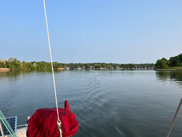
I had the alarm set for 6am but woke up at 5 and never got back to sleep.  Don't you hate that?  We pulled the anchor at 6:30am under a clear, calm sky.  It was a pretty day as we motored back out of the cove into Haverstraw Bay and turned north.

Oh.  I almost forgot to mention this....  Remember my thinking the boat hasn't been running as fast as she should?  Today when I pulled the anchor and started motoring out of the cove, I was just running low (1,200) RPM to warm up the engine.  I happened to look down at our GPS speed and we were doing over 4 knots.  Hmmm.  Is it fixed?  I wonder if our backing up last night (at fairly high speed) before anchoring got something loose from the rudder or propeller.  The boat seemed to be back to normal speed the rest of the day.  Yea!  I love it when things fix themselves!

I've sailed many places around the world and still think the Hudson River is one of the most beautiful waterways I've seen.  I love twisting and turning around the mountains and thinking of the American history of this waterway.

This picture is typical of the travel north on the Hudson with mountains on both sides.  Where does the river go?


I figured we would have help from the tidal currents almost all the way to Kingston - only 20 miles from Catskill.  Plus, we had mostly south winds that would also help push us north.

Not too many cruisers were heading north yet and I think we only were passed by 2 powerboats.  North of Newburgh, there were many small fishing boats trolling lines back and forth for Striped Bass that come up the river in the Spring to feed on spawning herring.  Here was a fisherman with a big one on the line.


I didn't take pictures of the many bridges, sights and town along the water because I've posted so many of them in past blogs.  But I did enjoy the ride and just took it all in on our last travel day.

I had heard from the marina owner that the docks were very full of boats heading north that were waiting for the Erie and Champlain Canal locks to open this Friday.  Our marina is one of the few with a crane and crew for taking down and putting up sailboat masts for the trip up the canals.  I took this picture of the marina on our way in.  There are about 15 sailboats at the docks that have already had their masts taken down.  This is just one part of the marina.  Many other boats are filling up the docks not in the picture.

We pulled into our normal, summer slip at 4:30pm and tied up quickly to end a very nice trip north from Marathon.  Laura had prepared Chicken Parmesan on the way up and my sister Denise and brother-in-law Tom brought our car down and joined us for dinner in the cockpit.  It was great catching up on the family and we enjoyed a few hours with good friends.

After dinner, we had to go to Cone E Island for ice cream dessert.  It's our favorite ice cream shop.  They have both soft (for Laura) and homemade hard (for me) ice cream.  It was just as good as I remembered.

Here is Second Wind kind of shoe-horned into her slip.  There is usually a smaller sailboat next to us for the summer but we had to work with what we had for now.  Yes.  It was a little tight getting into that slip.

I have a huge list of boat projects for this summer but nothing major like the electronics upgrades I worked on the past few years. Just need to work several things that need fixing and normal maintenance on engine, outboard, generator, etc., before we set sail again.

First I need to clean off that waterway beard!   


Cruising again

This trip north was a little hurried because of the timing for Laura's grandson's graduation.  Maybe we should have left a week or two earlier?  It was interesting for Laura and I to discuss our feelings about the last 6+ weeks because we both wished we had had more time to stop at favorite places for a few more days.  I think we've gotten used to taking as much trip time as we wanted for several years after we stopped our charter business in 2015.  When we were chartering, we always were in a hurry to get north and south because we had paid charters waiting.  Now we were used to taking it slow and didn't like hurrying.  

Also, as we get older, who knows how much longer we can keep cruising?  It's a very physical thing and can be dangerous or deadly if you don't do many things correctly.  We are both physically and mentally healthy right now but have both gone through harder "health" times.  It has given us a greater appreciation of being able to do the things we love because it's not going to last forever.  This trip from Marathon to Catskill was a normal thing for many years.  But, it's the first time in two years our health enabled us to travel that far in one shot.  

We're going to keep doing this as long as we can.  I really feel cruising is my "best destiny" and plan to keep enjoying the ups and downs until ....


Trip Stats

1,569 total trip miles (nautical)

Total days from Marathon to Catskill - 45 (44 nights)

    Anchored - 17

    Docked - 14

        5 nights free in Oriental

        4 nights free in Reedville

        3 nights at RE Mayo ($17 / night)

        1 night Thunderbolt Marina (Savannah)

        1 night Myrtle Beach Yacht Club

    Moorings - 13

Overnight at sea - 0 (first time in 17 years)


More???

If you've enjoyed our blog, it goes back 4 1/2 years of our travels on the U.S. East Coast and Bahamas.  We did keep a detailed blog before that and I've used it to published 4 inexpensive (less than $5) books on Kindle if you would like to read about more of our travels from 2007 to 2018.  You can find more information on our sailing books by clicking HERE.

Thanks for traveling along with us!

Sunday, May 14, 2023

Reedville, VA to Atlantic Highlands, NJ

Wednesday, May 10th (Day 39)

Cool and hazy but sunny after noon.  56 degrees.  Water temp 62.  Light E-SE winds

80nm today (1,204 total trip miles)

One of the most difficult parts (for us) of this trip from the Florida Keys to the Hudson River is the 170 nautical mile run across open water from the north end of Delaware Bay, around Cape May, and up the coast to Sandy Hook, NJ.  We look for a weather window of decent sailing and light seas (less then 4' if the waves are less than 6 seconds apart) or, more likely, calm winds and seas.  As we get older, we shoot for more comfort if possible.  In the past, we have waited up to 2 weeks for the right winds and seas to appear.  Don't forget, our deadline for getting to Catskill was before Laura's flight to her grandson's graduation on May 23rd so we couldn't wait too long this trip.

I'd been watching a possible window for this weekend which now started on Friday morning.  We would have to hustle to make that from Reedville.  We had about 150 miles from Reedville to the top of Delaware Bay which is a lot for us in just two days.

I wanted to make somewhere around Annapolis today if possible.  When I checked the tides yesterday, it showed we would have helping tidal currents for only a couple hours. Bummer.  We needed to get an early start again.

The alarm was set for 5:45am and we got up quickly (for that early) to get going.  We had said our good-byes to Walter and Mary last night after we got back to the house from going out to a Mexican restaurant for dinner.  They told us they would NOT be out waving good-bye this early.  I didn't blame them...

It was a calm morning as we untied our dock lines and motored the 5 miles from Cockrell Creek back to Chesapeake Bay.  Here we are motoring out onto a calm Chesapeake with the Sun peeking through the haze.

An hour later we crossed the Potomac River.  It was so calm you could see our tiny sailboat wake.

You have to keep diligent for big ships traveling up and down the bay.  Around noon, this large freighter passed us doing 18 knots.

I thought this was an interesting vessel.  It looked like 1/2 container ship (the front) and 1/2 car-carrier (the back).  I looked it up on-line - it was the Grande Senegal - a "Ro-Ro / Container ship"  Ro-Ro means roll-on, roll-off - like cars, trucks, etc.  I was pretty close!

Winds all day were light and from the NE to E.  I liked this sailboat heading south with a huge, red spinnaker catching the light winds.  You can't miss this boat on the water!

It was a beautiful day on the water as we motored up a calm Chesapeake Bay with the current against us for several hours.  

I wanted to anchor somewhere that was only a short distance back to the channel since we had a long way to go tomorrow too.  After searching the charts on my iPad, I found a new-to-us place in Mill Creek that looked protected and only about 2 miles (in and out) from the channel.  We would get there just before dark.  

We decided to eat dinner before anchoring and I grilled burgers on the back deck around 6:30pm.  We ate in the cockpit just before crossing the Annapolis harbor.

Mill Creek turned out to be a beautiful anchorage but a little tricky getting in.  We had to follow a well-marked but narrow and twisty channel to get into the deeper creek.  It all worked out well and we anchored just at 8pm.  Phew!  A 14 hour day to cover 80 miles

Weather still showed Friday and Saturday were good days for running up the coast.  Tomorrow (Thursday) was also a calm day and night so I planned on anchoring near Reedy Island at the northern end of Delaware Bay.  That anchorage is very open to winds and seas but should be nice with the calm night tomorrow.

Thursday, May 11th (Day 40)

Cool, calm and sunny.  60 degrees at 7am rising to 70s in the afternoon.  Water temp 62.

66 nautical miles today (1,270 total trip miles)

Yesterday I checked the tides and we should have helping current all day today for the run up Chesapeake Bay to the C&D canal.  This meant we could sleep in another hour in the morning.  Yea!

We pulled anchor at 7am and follow our incoming track from yesterday on the chart plotter to get back out of the creek through the narrow channel.  I took a picture of the pretty anchorage as we were leaving.


Less than 1/2 hour later we were able to turn north toward the Bay Bridge.

It was another beautiful day on the water and it seems like we zoomed up the bay - over 7 knots.  Lots of other cruisers were out and we were passed by probably 10 motorboats / trawlers before getting to the C&D Canal.

The Chesapeake / Delaware Canal (C&D) is a 14 mile long, 450 feet wide and 35 foot deep man-made canal between the north end of Chesapeake Bay and Delaware Bay.  It saves 300 miles for ships passing between Baltimore and Philadelphia / Wilmington.  For us, it saves a full day and night of off-shore sailing from Norfolk to New York City by letting us cruise up Chesapeake Bay then down Delaware Bay before entering the Atlantic Ocean at Cape May, NJ.  For small boats (like us), it is an easy trip although sometimes you have helping current and sometime the 1-2 knot current is against you.

This day it was helping us and we ran through the 14 miles in 1.5 hours averaging over 8 knots.  When we came out of the canal into Delaware Bay and turned south, the current was against us but we only had a couple miles to our anchorage.

There is a stone breakwater along the western side of Delaware Bay here to protect the Delaware shore (and our anchorage) from the big ship wakes.  We arrived at the narrow entrance through the breakwater near high-tide so the entire breakwater was under water.  If someone didn't know better, they could just drive a boat right onto it.

It was a little difficult to keep the boat moving in the right direction through the narrow entrance with 2-3 knots of current pushing you sideways.  As an experienced Captain, I understand the physics behind this but it's still a little concerning aiming your boat right at the stone channel marker so it gets pushed sideways through the middle of the channel.

Once through the breakwater, we motored north about 1/2 mile into shallower water (12-15 feet) and anchored near the Delaware shore at 4:45pm.  This time we had a chance to relax and have a little happy-hour before dinner and TV.  

I took this video of a 360 degree view around us at the anchorage just before sunset.

In the video I said the shore was Maryland.  It was actually Delaware.

The ebb (outgoing) tide at this area would start around 7am tomorrow.  That was almost perfect for us to get going a little before that and we would have helping current almost all the day down Delaware Bay.  The currents in the narrow, upper end of the Bay can run 3-4 knots so you barely go anywhere if you don't time them correctly.

I was not sure if or where we would stop tomorrow night.  We typically do this whole 170 mile section (from here to Sandy Hook, NJ) in one run because the nice weather for traveling by sailboat usually doesn't last more than a couple days.  For example, if you stop in Cape May or Atlantic City, you might be there 5 or 6 days waiting for another weather window to start moving again.  Tomorrow and tomorrow night looked fairly good so we just might keep going.

Yesterday we only averaged 5.4 knots all day because we had the tidal current against us most of the time.  Today we averaged 7+ knots because they were helping us.  If you are traveling these waters, it helps a lot to time the tides right.

Neither of us enjoys these overnight sails up or down the coast because it wipes you out.  The boat is usually moving around enough that you can't get any meaningful sleep so, when you finish the trip, you feel sleep deprived for a couple days.

I can say from experience that if you do longer overnight sails, typically you sleep much better on the 2nd and 3rd nights - mostly because you are so tired from not sleeping the 1st night.

We hit the sack early after two fairly long days from Reedville and both slept well.

Friday, May 12th (Day 41)

Warmer (until the ocean), sunny and calm (again until the ocean).  Winds light in the morning and S in the afternoon.

88.5 nautical miles today (1,358.5 total trip miles)

We were up early and pulled the anchor at 6:20am.  As we motored back through the narrow channel in the breakwater back to Delaware Bay, the ebb current had already started and we zoomed south on another calm morning.  We and 2 other sailboats passed the Hope Creek Nuclear Generating Plant a few minutes later.


We had coffee and breakfast underway as we listened to the engine drone.  A few hours later we motored into the more open area of the bay.  It was just about the calmest I had ever seen Delaware Bay.  Notice how glassy the water was. I think it’s neat when you have a hard time telling where the water ends the the sky starts.

The winds were calm almost all the way down the bay until about 10 miles from Cape May.  Then the predicted south winds started and I hoped we would be around the cape and running NE instead of S like now before they picked up.

It worked out great and we motored around Cape May a few hours later.  Our course though the Prissywick Shoals saves us over 10 miles of following the big ship channel out into the deeper Atlantic before turning around the cape.  But, it does bring us within 1/4 mile of the beach which is not nice on days when winds are pushing you that way.  Laura took this picture of the lighthouse.  This was not zoomed in. 

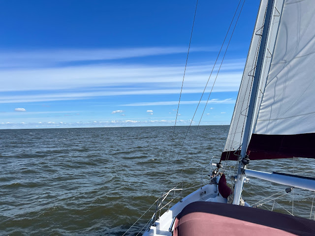
The south winds were building but only about 8-10 knots now.  We had the mainsail out to help push us against the current and get around the cape.

It's always interesting to me how the currents churn up the water here.  Because we always come down the bay with helping currents at the north end, by time we get to Cape May they are 1-2 knots against us.  This creates current waves in the water when the incoming ocean water gets pushed though this (somewhat) narrow channel.  Laura took a great video showing us going though one of these churning spots. Imagine going through here on the dark and hearing the water roiling around the boat but can’t see it.  We’ve done that several times when the tides are not as timely as today.

A short time later we turned east then northeast as we rounded the cape.  This put the winds on our starboard beam then a little behind us.  We were able to roll out the jib and get a lot of speed help from the two big sails.  An hour later we sailed passed the Cape May inlet and were out of most of the current pushing against us so our speed picked up to over 6 knots.

From Cape May inlet to Atlantic City inlet was 33 nautical miles. I really didn't want to stay in Cape May because we would have to leave at something like 4am to make it to Sandy Hook (110 miles away) in the daylight tomorrow.  And, we only had 1 more day of nice travel weather.  Sunday morning was bringing north winds in the 15-20 range for several hours.  

We continued up the coast as I tried to work farther off-shore which might calm down the SE swell a bit.  Even with the big sails up, that short (4 second?) swell was rolling us around pretty good.  My plan was to see what the ride was like when we got to Atlantic City (now 5 hours away) then decide to either keep going and be in Sandy Hook early tomorrow, or pull in and anchor for the night.

By time we motor-sailed passed the boardwalk in Atlantic City, both Laura and I had had enough of the SE swell bouncing us around.  Plus, the travel forecast for tomorrow looked pretty good now with only a 50% chance of rain in the morning.

We pulled in the jib and used the mainsail and motor to push against the ebb current at Atlantic City inlet.  The anchorage here is about 2.5 miles from the outer marker so it took about 1/2 hour to run in, turn up-wind to pull in the mainsail, then motor NW toward the anchorage.

I had been in this inlet many times in the past but just remembered I had never anchored here before - we’ve always gone into the marina.  I could see where the anchorage was behind a shallow area and there was a small powerboat anchored right where I had planned on going.  I motored passed him and we dropped anchor a short distance away. Dang.  The winds push our sailboat around a lot compared to a small powerboat.  They were pushing us towards the anchored boat and not pushing him away.

Oh well...  back up and regroup....

We pulled up the anchor and motored about another 100 feet away before dropping again at 7:30pm.  This seemed to me like a nice distance between us that I wouldn't have to worry about.  I set our anchor alarm, shut down the boat and we relaxed below with a late dinner.

This has happened to me so many times in the past that I shouldn't be surprised.  I seem to like a lot more space between anchored boats than most folks....  1/2 hour after we anchored, a 40+ foot Kady Krogen powerboat slowly motors passed us and anchors right between us and the other anchored powerboat.  Now, it seems to me that all three of us are too close.  Plus, we're the only sailboat so we will react differently than the other two boats to the winds and currents.  By now I was pretty tired and there was really no anchoring room left for us to move.  C'est la vie.  I went back downstairs to relax before hitting the sack.  For some reason, I didn't even lose any sleep over this.  

I took this picture before the tide changed an hour later.  After we both turned around with the changing tide, we were only about 50 feet from the Kady.

Tomorrow we have 80+ nautical miles to the anchorage at Atlantic Highlands.  Gonna be an early start again to try and make it there before dark.

Saturday, May 14th (Day 42)

Cool (on the ocean) - 60s.  Winds light south in the morning going to SW in the afternoon.  Sea temp 60.

Last evening, I decided to try and get a mooring in Atlantic Highlands for tonight instead of fighting the other cruisers for the best anchoring spots.  Winds were supposed to go north on Sunday morning and there were only a few anchoring spots behind the breakwater with protection from north winds.  The rest would be open to the north wind and waves coming down the 10 mile bay.  I used the DockWa app on my phone to request a mooring.  Geez.  They had raised the price another $5 from last Fall.  Now they were $65 / night.

This morning I saw that there were a couple chances of north winds Sunday and Monday morning.  Plus, Laura and I had been putting in some long days so it would be nice to relax a bit on a mooring where I wouldn't have to worry about some hoople-head "snuggling up" by anchoring right next to us.  I sent a message on DockWa requesting a second night.  They sent me a confirmation later in the morning.  We had a place to stay for the next two nights!

We pulled up anchor at 6:15am onto another hazy morning.  Winds were light out of the south but still kicking up steep, short waves in the inlet that were bouncing us around.  This is typical in NJ inlets and you just have to tell yourself things will get much better once away from here.

By the time we motor-sailed back into the open ocean (with several large powerboats), the seas had calmed and we were able to motor-sail at 6-7 knots up the coast.

I took this picture of Atlantic City behind us.

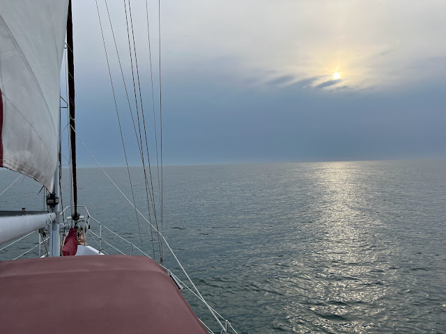
About an hour later the Sun peeked through the haze.  We just had the mainsail up and sheeted in tight for roll-control.  I was starting to hate that SE swell....

Running up this section of the NJ coast you start NE then gradually turn N during the day.  That put the SE swell more behind us which made for a better ride.  Plus, a SW wind built in during the afternoon and we were actually able to sail for a couple hours with Jib and Main - no engine drone!  The ride was so nice that both Laura and I were able to get naps in the salon.  That doesn't happen often on the ocean.

Just passed Manasquan Inlet, the boat seemed to slow down for no reason.  We had 12-14 knots of wind on the beam and, with the two big sails out, we should have been doing 7+ knots.  Our speed-over-ground was only showing 5.5 - 6 knots.

I'm the type of person that notices this kind of stuff right away plus I don't just let it go.  Something was wrong.  I thought maybe we had picked up a lobster trap or other marker with a line and we were dragging it behind us.  Usually you can see this in the water right behind the boat but there was nothing there.  One thing I did see was the boat seemed to be really moving fast through the water (like it should with these winds pushing us) when I looked at the water going by the side.  Maybe this was just some kind of contrary current?  We don't have a pickup for measuring the boat speed through the water which would have shown if we had some crazy current against us.  It lasted for a couple hours and I racked my brain trying to figure out what it was.  I even started the engine and put it in reverse to see if there was a line caught on the prop.  Eventually, the boat picked up speed back to "normal" so I guess it was a southbound ocean current right next to the coast. In 35 trips I’ve never seen this before along this coast.

About 5 miles from Sandy Hook, Laura looked up and said, "A Whale!"  I slowed the boat down and we watched for several minutes as a small humpback whale spouted and surfaced off our starboard and behind us.  Unfortunately, we never got close enough to get a good picture or movie.  Laura's first whale!  She was so excited.  

We scraped and blew-up this picture from a long-range movie she took.  Not too impressive, is it.


 Around 5pm we could start seeing the New York City skyline and had a great view when we motored around Sandy Hook at 5:30pm.  The Varrazano Bridge is on the left with NYC skyline to the right.

With the sails in and the boat steady, Laura went down to make chili for dinner as I motored us south to the highlands.  We found our assigned mooring and tied up at 7pm.  Yea!  We had completed another NJ coast transit and didn't even have to run overnight.

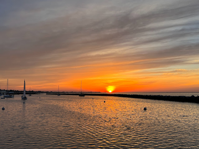
Dinner was in the cockpit as the winds calmed and we watched a pretty sunset.

Oh.  We could have anchored behind the breakwater because there were only a couple anchored boats but they were just along the southern shore.  Oh well.  We won't get any of the ferry wakes here either because we are way down near the middle of the breakwater.  We're here for a couple nights and can relax now.

Sunday, May 15th (Day 43) - Happy Mothers Day to all the great Moms out there!

57 degrees in the morning going to mid 70s today.  Windy but calming later on.  Water temp 58.

Not moving the boat today.

Ahh.  Sleep in and relax.  No getting underway at 6am today.  But, wouldn't you know that I woke up and looked at the clock - 5:30am.  I could hear something banging with the high winds up on the deck so had to get dressed and fix a solar panel that was a little loose.  I came back to bed and slept great for another couple hours.

Laura and I spent a quiet morning enjoying the warm Sun in the cockpit.  We watched as the water-taxi from the marina brought lots of sailors and their families out to their boats for a fine Sunday sail on the bay.  Our mooring fee includes the water-taxi for free.  I don't think we're going to use it because we probably would have a hard time finding a restaurant on Mothers Day.

We definitely could have left today for our trip north but I was happy to just sit back and relax enjoying our day off.  Now there was little to keep us from making Catskill several days before Laura's flight except for maybe the boat breaking down (KNOCK ON WOOD!). 

Since the flood tide in New York City doesn't start until the early afternoon tomorrow, we will take our time in the morning and sleep in again.  Plans are to leave the mooring around 11am, motor over to the fuel dock for diesel, then head north again to start the 100 mile trip to the Catskill Creek.  We'll anchor somewhere around Haverstraw Bay tomorrow night then probably be in Catskill Tuesday evening.

I'm looking forward to having and driving a car again after 4+ months without one!

Tuesday, May 9, 2023

Hobucken, NC to Reedville, VA

Tuesday, May 2nd (Day 31)

Partly cloudy and warm.  Winds NW @ 10-15.  Temps gradually rose into the 70s

25.5 nautical miles today (945.5 total trip miles)

It looked like the winds and seas would be good for crossing the Albemarle Sound in 2-3 days.  Our plans were to run two short days with the first to the south (actually western) end of the Alligator - Pungo canal then another fairly short day tomorrow to the Alligator river.  From there we would make the run across the sound.

We slept in, had a nice breakfast then took a walk in the morning.  Laura picked these wild-flowers during our walk and they brightened up the boat.

Around noon we untied our docklines and continued our trip north up Goose Creek toward the Pamlico River.  It was a nice ride and we were happy to be underway again.

An hour after leaving the dock, we turned NE to cross the Pamlico River.  Winds were now a nice angle for sailing so we rolled out the jib, tightened in the sheet, and turned off the engine.  I love that sound when the engine is off and you only hear the wind and water.  Here we are sailing across the Pamlico River.


We sailed up the Pungo River toward Belhaven then turned east - keeping the engine off for over 2 hours.  It was great to review some of our sailing techniques including jibbing the jib (turning the stern of the boat through the wind) when we made the 90 degree turn at Belhaven.

After making the final turn toward the canal, we pulled in the sail and slowly motored to the western shore.  I tried to get close to shore (about 1/4 mile) because the winds were blowing the waves around the corner and into our anchorage. We anchored at 4:45pm.  The winds died later in the evening and we had a calm evening at anchor.

I took this picture just after sunset.

I was thinking that the next few days might be challenging to get through Great Bridge and Norfolk because of problem caused schedules with the Great Bridge lock and Gilmerton Bridge.  Boy.  Was I in for a challenge!

Wednesday, May 3rd (Day 32)

Mostly sunny and warm.  Winds out of the west at 10-15.  70s again.  Water temp 62

31 nautical miles today (976.5 total trip miles)

Knowing we had another short day today we slept in a bit and pulled the anchor at 9:30am.  It was only a short motor to the canal that we entered just ahead of a catamaran who was having a problem with one engine so they were only running about 5 knots.  Typically catamarans would leave us in their dust.

The 21 miles of the Alligator - Pungo canal are one of my least favorite parts of the trip,  You have to pay special attention to not let the boat drift more than about 100 feet right or left as there are stumps just under the water that will grab your keel.

We made it without issues to the Alligator River.  I had planned on anchoring in the south end of the river but the winds were more northwest than west which might make that spot a little bumpy.  Instead I decided to motor another hour north and anchor along the western shore just passed Catfish Point.  

Along the way, we were passed by the great looking powerboat.  Sorry.  I forgot to write down the name.

I didn't want to anchor too close to shore because we've had problems with the anchor catching logs and stumps along here before.  Instead, we anchored about 1/2 mile from shore at 2:50pm and shut down the boat from cruising.

I guess because the winds were NW instead of W we had 1-2 foot waves coming right down the river and making our anchorage a little rolly.  Finally, just before sunset, I decided to move the boat a little closer to shore which might calm us down a little.  Laura didn't complain as we performed our normal pull-the-hook activities, move the boat about 1/4 mile closer to shore, then drop-the-anchor routine.  It probably took us about 15 minutes and the boat seemed a little less rolly.  Yea!

Wouldn't you know, about 1/2 hour later the winds died and all the waves went away.  

The next couple days would be long so we hit the sack early.

Thursday, May 4th (Day 33)

Sunny and cooler.  Winds W @ 10-15 with gusts over 20.  

31nm today (1,007.5 total trip miles)

Temps were in the high 40s last night and we started the day with sweatshirts and sweatpants.  We pulled the anchor at 8am and motor-sailed to the Alligator River Bridge.  No problems at the bridge which opened just as we got there.

We motored to the Albemarle and I thought it would be a nice sail with the direction we needed to go.  Winds had been honking here for the past week so this was our chance to get across.

As we made the last turn onto the sound, we rolled out the main and jib - both with a single reef (didn't put out the full sail) because of the gusty winds.  Plus, we didn't need to hurry because we were going to anchor at the north end of the North River which is only about an hour from the other shore.

I set course for the North River inlet 13 nautical miles away.  The boat was moving around only a little with the 15 knot winds and 1-2 foot seas.  It was a pleasant ride for us.

Only an hour into our crossing the winds picked up and the wind angle moved forward a bit.  Dang.  Now we were beating close to the wind (which heels the boat over more) and the waves were getting bigger.  Now it wasn't much fun....

I had to run the boat east of our desired course in order to keep sailing.  I kept hoping the winds would veer back to the west and we could sail the rest of the sound.  When we were 4 miles from the inlet, I finally decided we couldn't make it under sail unless we tacked back to the west.  Winds were now in the low 20s and gusting to high 20s.  I decided to turn downwind and pull in the jib so we could motor-sail, with help from the mainsail, back to our desired course and the North River inlet.

It actually worked out pretty good except for how hard it was to pull in the jib in the high winds.  But we got it rolled up and the boat ran much better motor-sailing 40 degrees off the wind toward the inlet.  By time we got to the inlet and the winds / seas died, our cockpit windows were cover in salt from the spray.

Winds were on the nose as we turned up the North River so we pulled in the mainsail and just motored against the winds and seas.  Both had calmed to reasonable levels and we had no problems motoring to the anchorage.

A short time later we were passed by a tug and long barge heading south.  Give these guys lots of room!


I decided to anchor here because there are no good anchorages (that I like) between here and Great Bridge.  There is a decent anchorage about an hour away just before Coinjock Marina but we'd be swamped by powerboats until nighttime.

We dropped anchor at 1:30pm just south of Buck Island.  It was peaceful and quiet.  Later in the evening we enjoyed this pretty sunset.


I wanted to give us as much time as possible to get through the bridges and lock tomorrow so we hit the sack early.  I set the alarm for 5:15am.

Friday, May 5th (Day 34)

Sunny and cool again.  Light north winds.

62 nautical miles today (1,067.5 total trip miles)

So.... here's are problem for today.  The Great Bridge Lock is running on generator power so only locking boats every other hour, on the even hours.  6 miles north is the Gilmerton Bridge.  This is the only other bridge north of Great Bridge that needs to open for us to get through.  They are doing maintenance on the weekends and only opening at 7am and 5pm (Saturday and Sunday).  Also, the Gilmerton Bridge is closed to boats for rush-hour traffic from 3:30pm to 5:30pm during the week.

If we stay at the Great Bridge free dock tonight, it would be a pain for us to get through that tomorrow - Saturday.  We'd have to go through the lock at 2pm to make the 5pm Gilmerton bridge opening.  We probably anchor somewhere along with waterway for a couple hours.

Instead, I was trying to get through all that today.  If it didn't work, maybe we'd stay in Great Bridge for the whole weekend.

As we were getting the boat ready to pull anchor, Laura noticed the moon setting to the west while the sunrise brightened up the eastern sky.  I took a couple pictures.

This was the moon-set....

And the pre-sunrise..

 
We pulled anchor at 5:50am and motored toward Coinjocks on a calm morning. As we approached the narrow waterway around Buck Island, there was a haze forming over parts of the water that looked pretty cool.


Since we had made an early start, I tried planning for the bridges and lock today.  It looked like we could make the North Landing Swing Bridge for their 11:30am opening (they open every hour and 1/2 hour).  Then the Centerville Bridge at 12:30pm (same schedule).  This was only 1/2 hour of travel for us to Great Bridge so we should be there around 1pm.

Great Bridge Bridge and Lock would open at 2pm so we'd have an hour to stop at Atlantic Yacht Basin for fuel, water and pump-out.  Then through the bridge and lock at 2pm then be at the Gilmerton Bridge before their 3:30pm lockout until 5:30pm.  What are the odds this would work?

Here we are in the Great Bridge Lock with 9 other boats for their 2pm lock.


Other than a few minor hick-ups (like waiting 20 minutes for the fuel dock at AYB) it worked out great until we were motoring around the last turn to the Gilmerton Bridge at 3:15pm.  We heard on the marine radio "Norfolk Southern bridge 7 is about to close".  Oh crap.  That didn't fit in my plans.

This railroad bridge is right next to the Gilmerton Bridge and we watched it close in front of us as we motored up.  There are several railroad bridges along this stretch from Great Bridge to downtown Norfolk and you never know when they will close or how long with will stay down.

I called the Gilmerton bridge tender on the radio and he said he had a little leeway if the railroad bridge stayed closed passed 3:30pm.  Ok.  Worse case we have to sit here for 2 hours until Gilmerton can open for us at 5:30pm.  We waited and watched...

Only a few minutes later TWO TRAINS came over the bridge at the same time.  How nice of them to synchronize for us!

At 3:25pm the railroad bridge opened and a few minutes later the Gilmerton Bridge opened for us.  Yea!  We were free!

But wait...  There were still 3 other railroad bridges between us and Chesapeake Bay.  Would they be nice?

Turns out we had no other delays and motored passed ICW Mile 0 (Hospital Point) at 4:30pm.  1,200 ICW miles from Marathon in just under 5 weeks.

Three other sailboats that had gone through the lock with us decided to anchor here.  Since it was fairly early in the evening, I was going to take advantage of the nice weather and go another 10 miles to a new anchorage for us - Old Point Comfort.  Our friends Dean and Sue like that anchorage so I thought we'd give it a try.  It will make our day tomorrow shorter for the run to Reedville.

No problems the rest of the day other than a very busy upper Norfolk Harbor.  We had to move to the other side of the channel for a huge coal tanker (coming in), then move back for a container ship (going out).  Geez.   This place is crazy!

Just after 6pm we motored into the bay at Old Point Comfort.  There were a couple other boats anchored and I found a nice spot away from them in the quiet anchorage.  We made it!  Phew.  What a day!

This anchorage has a highway right next door but the road noise didn't bother us down below in the boat.  We spent a quiet evening watching TV and went to sleep early after a VERY busy day.

Saturday, May 6th (Day 35)

55nm today (1,124.5 total trip miles)

Cool on the water.  Sunny.  High was near 70.  Light winds

I had moved the alarm clock to 6:15am (we got to sleep in a whole hour later than yesterday) and we were both up and raring to go for our first trip in a long time not in the narrow, busy ICW.

Anchor up at 7am and we motored out of the anchorage, around Old Point Comfort and onto a very calm Chesapeake Bay.  I had checked the tide tables yesterday and we should have a helping current most of the day once we get a little farther north.  

Here we are at the southern end of Chesapeake Bay.

We had a calm, easy motor to the Wicomico River 8 hours later.  We averaged 6.5 knots and got to the dock an hour or two earlier than I had thought.

Here we are on the last stretch to Walter and Mary's dock.  Their house is the large white one in the middle of the picture.

By 3:30pm we were tied up to the dock and putting the boat to bed for a couple days.  Walter and Mary were going out to a concert (they are big music buffs) so we were on our own for dinner.  

We put together a couple loads of laundry and walked up to the house to use the washer and dryer.  I thought because we were early they might still be home but the house was empty.  They had told us to come right in if they were not home.

As we were loading the washer, they pulled into the garage.  Turns out they were doing some shopping and the concert wasn't until later.  So, we welcomed them home (hehe).

Everyone decided we needed happy-hour on the porch so we made cocktails and munchies then met them back at the house.  It was a great reunion and I played a few songs on the flute that I had been working on.  They left for the concert around 6pm and we relaxed on the boat for the rest of the evening.

Sunday, May 7th (Day 36) to Tuesday, May 9th (Day 38)

Sunday would have been a decent weather day for traveling north (not north winds) but we decided to stay at least one more day to enjoy Walter and Mary's company.  Monday and Tuesday's forecast changed to north winds so we again extended our stay until Wednesday. 

Sunday we didn't do much of anything and just hung around.  We again had happy-hour on the porch and this time I brought my guitar for some fun island music.  Laura and I made dinner (in their kitchen) of seafood stir-fry with linguini. Mary had stopped at the local seafood store and picked up fresh calamari, shrimp, scallops and cod.  We brought a lobster tail that our friend Bob had given us just before we left Marathon.  We also added onions, water chestnuts, broccoli, peppers and a few other odds and ends. Olive oil, white wine, salt, pepper and a little crushed red pepper fill out the rest of the recipe.

I'm pretty good at timing everything going into the dish so most things are cooked but not overdone.  We've had this dish over 50 times and this was the best.  Check it out...

After dinner and another one of Laura's awesome deserts, we rolled ourselves back to the boat for a quiet night at the dock.

Monday I helped with a few jobs around the yard, did a thorough cleaning of the boat, and we again had cocktails and dinner at the house.  This time Mary made fresh Chesapeake crab cakes with homemade tarter sauce, corn on the cob, tomato / cucumber salad and asparagus.  Yumm!

It is now Tuesday afternoon and I've been writing this blog for the past couple hours.  Mary had taken Laura to a ladies group meeting where they were treated to a behind-the-scenes tour of a theater.

We're going out to dinner tonight so the gals (and I) don't have to cook.  Not sure where yet.

Our plans are to head out early tomorrow morning for a couple long days up Chesapeake Bay to stage for a possible run up the NJ coast on Friday and Saturday.  It's always hard to rely on weather forecasts more than a couple days ahead but we'll get to the northern end of Chesapeake Bay and see what happens from there. Wish us luck!

Monday, May 1, 2023

Oriental, NC to Hobucken, NC

Wednesday, April 25th (Day 24) to Friday, April 27th (day 26)

We continued our stay in Oriental Harbor Marina at our friends Bryce and Helen's dock doing some walking around town and enjoying some shore life.  The weather was not nice for traveling on the water with high winds and storms coming through on several days so we stayed at the (mostly) protected marina.  This marina is open to the SW onto the Neuse River so the ride at our slip was bumpier than some anchorages we have stayed at this trip.  But, we had easy access to shore and power for running the heater on cold mornings.

A few days ago, Laura found a new recipe and decided to make a Banana Pudding Cake for dinner on Southern Cross.  Everybody thought it was awesome with the chocolate and banana flavors.  

We enjoyed several meals with long-time friends D and Don (we met 17 years ago while both cruising Grenada) including a nice dinner at the marina restaurant Barcos Thursday evening.  D ordered the "Big Ass Nachos" for an appetizer.  The tray almost filled up our whole table.  (Not sure why Don was so serious when I took this picture.)

Friday afternoon we had a little going-away get-together at The Bean just a short walk from the marina.  It was the first ice cream I think we've had in a couple months.  The place was hopping because there was a big bicycle rendezvous in town and many of them stopped for ice cream too.

That evening we saw what we thought were flashing lights outside the boat which turned out to be a large thunderstorm passing north of us.  Here is a short video I took of the lightning.  I'm so glad we were not under this.


Saturday, April 29th (Day 28)

Sunny, warm and calm.  

21nm today (920 total trip miles)

Another front with thunderstorms and high SW winds was forecast for Sunday so we decided to bail-out of Oriental Harbor Marina and head to a more protected spot.  Laura and I discussed our options and decided to spend a couple nights at the R.E. Mayo seafood docks.  We've actually sat out multi-day storms here in the past and were quite comfortable.  There are no stores or restaurants within walking distance other than the seafood and small grocery at the marina.  But, it's inexpensive (less than $20 / night), protected (no open water to build waves) and the price includes shore power (only 20 amp service at our dock).

During my morning engine room checks I noticed water under the sea-strainer I had just fixed a few days ago but couldn't find any drips on the strainer.  That was weird....  While checking the engine I noticed the bilge had a little water in it so turned on the bilge pump.  Water went squirting everywhere from a broken bilge pump hose.  Time to put on my plumbers hat.  

The hose was in pretty bad shape but I thought maybe duct-tape would seal it up enough to maybe get us back to Catskill.  After about 1/2 hour of taping, I still had water going everywhere when I turned on the pump.  I needed to replace that section of hose.

Laura checked under the salon floor where we keep our spare hoses.  She came up with the right size hose and it was long enough to bypass the broken section.  It only took me about another 1/2 hour to replace the hose and now it worked great.  Nice.  I thought we might have had to stay here until I could find a replacement hose in town.  

D came down and helped us off the dock which was pretty easy with the light winds.  By 9:45am we were backing out of our slip and turned toward the Neuse River.

The river was very calm and we enjoyed the sunshine and couple hour ride to RE Mayo.  I had tried to get to the dock with the current behind us but, even after several hundred dockings in 35 years, I couldn't get the boat to the dock safely this time.  It was a perfect storm against me - the current tried to push us away from the dock and our propeller pulled the stern away each time I put the engine in reverse.  I wanted to get the bow pointed into the storms tomorrow and I knew it was going to be a challenge but thought I could make it work.  Nope.  Not this time.

I turned the boat around and we tied up in 2 minutes on the other side of the boat.  I couldn't figure out a way to break the helmsman's rule of "always dock into the current or into the wind."

By 1:15pm we were tied up at their docks.  I even put on extra bow and stern lines because the predicted winds tomorrow would be blowing us away from the dock.  The forecast called for 20-30 knot winds with 40 knot gusts.  Yikes!  Only issue we had was the dock here only had 20amp service - same type of plug as your wall outlets.  It took me a while to find the 20 - 30 amp adapter I had hidden away a few years ago.

I walked up to the office and paid for 2 nights ($34.40).  While looking around the fairly large ships store, I found more of the bilge hose I had replaced this morning.  Score!  I gladly paid $19 for 15 feet of new hose.  This made me feel much better about having to replace more of it in the near future.

We relaxed and streamed a few shows in the evening off the Starlink.  It was nice to be on a calm boat again after all the rock 'n rolling we did in the marina.

Sunday, April 30th (Day 29)

Cloudy and windy with rain and thunderstorms.

Thunderstorms and rain came through in the early morning then cleared up around noontime.  We took advantage of the nice weather and took a walk about a mile around and up onto the high-rise bridge just north of the marina.  I took this panorama from the top of the bridge.  

What are the odds.....  Several cars / trucks had stopped at the top of the bridge just before we got there.  I thought maybe someone was enjoying the scenery.  Nope.  This group of family and friends were having a memorial service for a family member and spreading the ashes from the bridge.  It was a great place to do it but we didn't want to hang around and interrupt the memorial.  These are the cars and people in the panorama.

A short while later the storms were heading our way again.  We are at the blue dot in the weather radar picture.

We sat in the cockpit and watched the storms going north and south of us.  It did rain a lot and we had some winds in the 20s but all the really bad stuff missed us.  We were pretty happy.

By 6:30pm the Sun had come back out and the winds calmed down.  I took this picture of the calm water behind us while grilling burgers.  The temps had dropped into the mid-60s after the storm and it felt chilly.

Once again we had a quiet night on the boat streaming shows and relaxing after the big storms were finished with us.  

Monday, May 1st (Day 30) to .....

Partly cloudy and cooler.  

After spending quite a while checking weather forecasts, we decided to stay here at least one more night.  D had driven Laura for groceries and we were fully stocked for at least a couple weeks so no worries there.

The weather here is quite nice with winds in the 15 knot range for the next couple days.  Our problem is farther north the winds are honkin' and won't calm down until Thursday or Friday.  One of the more open areas we need to cross is Albemarle Sound - about 50 miles from here.  This is a huge sound and the area we need to cross is 13 miles wide.  It is fairly shallow (15-20 feet) so winds kick up short, steep waves that can be very uncomfortable to dangerous.  We always try to plan our crossing there for settled winds which won't happen for several days.

So....  we paid our dockage for another night ($17.20) and spent a quiet day on / around the boat.  I did get a walk around the marina to check out all the heavy equipment stored (buried?) around the grounds.  Here is Second Wind at the docks.

Laura took this picture off the bow showing the huge seafood factory and off-shore fishing boats tied up a little north of us.

Plans are to maybe work our way north tomorrow or Wednesday to be ready to cross the Albemarle Sound at the earliest possible time.  We might also get some nice weather for heading up Chesapeake Bay the coming weekend.  Stay tuned.....